
Features
- Show Google Maps in any part of the website by simple component.
- Many map styles thanks to Snazzy Maps.
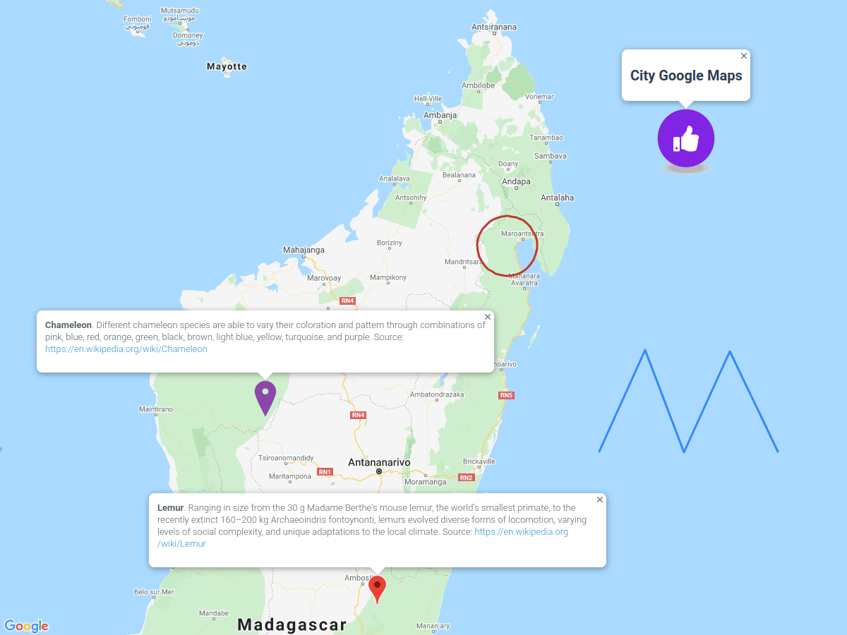
- Data Layers for the maps: traffic conditions, public transport network, bike paths.
- Configure map controls, e.g. full-screen mode, map type switcher, scale, etc.
Besides, many other features exist which are inherited from the parent plugin. Because the “City Google Maps” plugin is part of the “City Dynamic Maps” plugin.
The following plugin is required


Installation via Command Line
php artisan plugin:install City.GoogleMaps
Requirements
The “City Dynamic Maps” plugin is required and is using for managing maps and data.
Display maps
A map appears on the page in two steps:
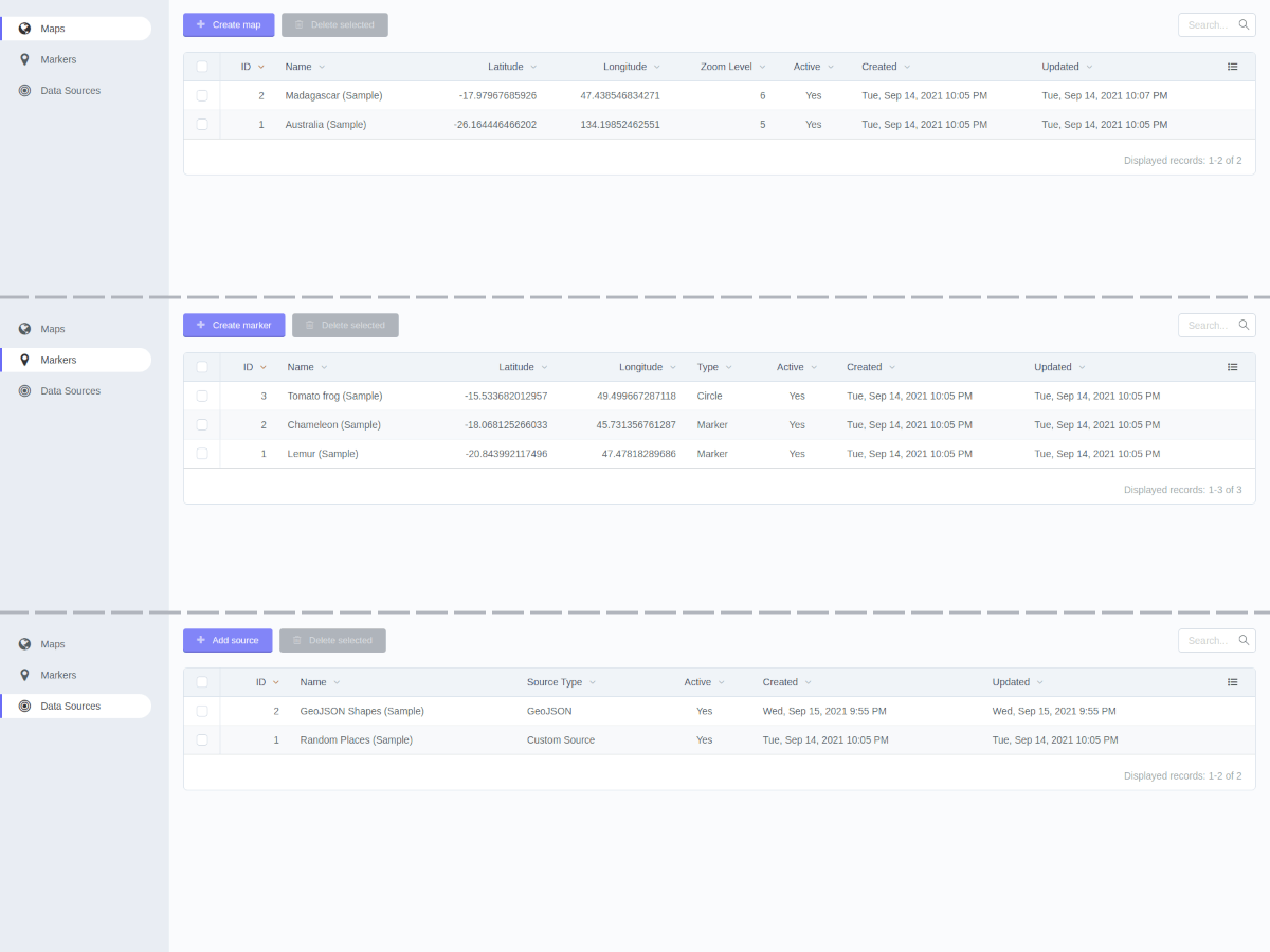
- Create a map under Backend Menu -> Dynamic Maps -> Maps. There are the basic map configurations and the possibility to choose markers and data sources.
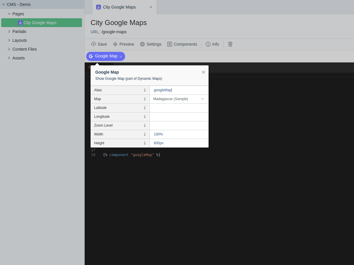
- Add the component to the page where the map should appear.
Configure component
Need to select one of the created maps in the component “Map” field. Optionally, can specify "Latitude", "Longitude" and "Zoom Level". Otherwise, appropriate values from the selected map will be used. Can specify the map size with the “Width” and “Height” fields (in px, em, or %).
Settings
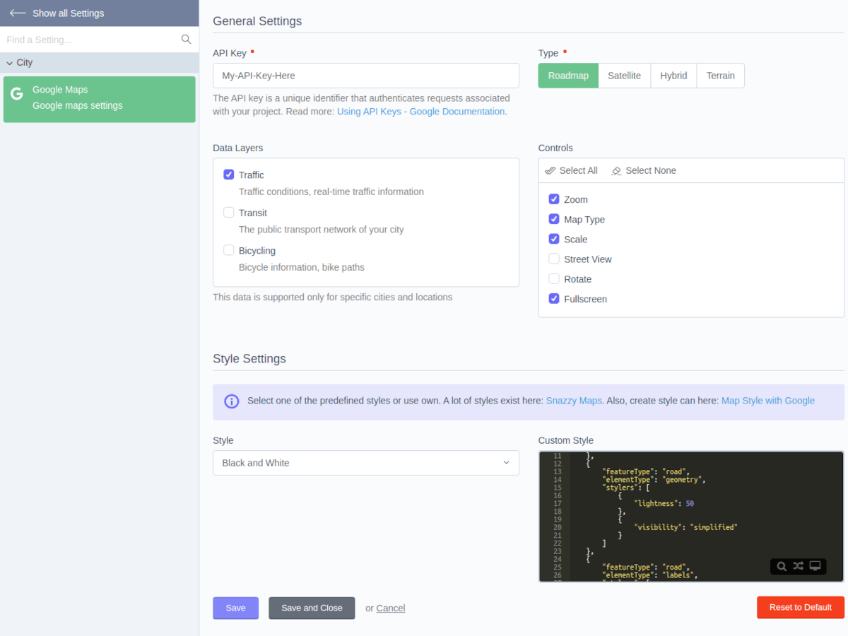
The plugin settings are here: Backend Menu -> Settings -> Section "City" -> Google Maps.
Google Maps API Key
The API key is a unique identifier that authenticates requests associated with your project. Please check Using API Keys - Google Documentation for more details.
Map styles
The "Style" field contains the predefined map styles. Also, it is possible to choose the "Custom Style" option and specify any other style in the "Custom Style" field.
More styles:
- A lot of styles exist here: Snazzy Maps
- Create own style can here: Map Style with Google
-
This plugin has not been reviewed yet.
-
| 1.0.1 |
Added scripts async loading Jul 21, 2024 |
|---|---|
| 1.0.0 |
First version of City Google Maps Oct 01, 2021 |